
The Lake Titicaca map, located 12,507 ft on the frontier between Peru and Bolivia, west-central South America, shows interesting points where the Tiahuanaco civilization, a precursor to the Inca Empire, left vestiges of its advanced stone-based architecture, beside touristic points, islands, and its weather. Perfect before travel! And when we refer to Lake Titicaca, we mean the highest navigable lake in the world. Therefore, together with the Machu Travel Peru team, we have prepared a small article about the Lake Titicaca map. Know in-depth everything you need to know about this beautiful place before enjoying it.
Everything you need to know about the Lake Titicaca map
Lake Titicaca map
The Lake Titicaca mean stone cougar. It is due to an ancient legend that affirms that men, at the beginning of the time, were protected by the Gods of the mountain (Apus) and lived happily in a valley settled in what is now the lake. They only had to fill a condition, don’t climb until the top of mountains, where the “Holy fire” was located. Unfortunately, the devil tempted them, and they began to climb the mountain, the Apus, realizing the disobedience of the men, sent wild cougars to devour them. The felines ate them all except a couple (Manco Capac and Mama Ocllo, the first Incas). The sun, seeing the slaughter, began to cry, flooding the entire valley into a lake and turning the pumas into stones.
Titicaca location
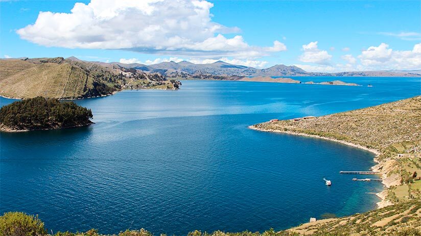
As we mentioned before, this wonderful destination is the natural border between two nations: Peru (southeast) and Bolivia (Center west). Also, Lake Titicaca is considered the highest navigable lake in the world, because it is located over 12,500 ft in the center region of South America, in the Andean plateau. If we wanted to go from Machu Picchu to Lake Titicaca, we would have to head southeast, first taking a train to Cusco (3 hrs), and spending a night there. The next day we would have to take a flight from Cusco to Juliaca (1 hr) and from it, took transportation heading to Puno (2 hrs), the city that hosts the Titicaca lake.
So, it is a truly easy zone to locate. In addition, the Lake Titicaca map shows an extension of 8,375 square kilometers. Most of Lake Titicaca is within the Peruvian territory, specifically, 60%. Precisely this western part of the lake is within the Puno Peruvian region. While the remaining 40% of the lake is within Bolivia. This would be the eastern part of the lake and is located in the Bolivian department of La Paz. While the shores of the Lake and its surface is located about 3 meters above the exit in the border Bolivian city of Desaguadero.
Hydrology
The Lake Titicaca map reveals that the Lake is made up of two large basins that connect through the Strait of Tiquina. This strait is a few 800 meters wide at its smallest point. The largest basin is called Lago Chucuito or Lago Grande. This has a depth of just 281 meters and an average depth of 135 meters. The other basin is much smaller and also shallower. It has a maximum depth of 40 meters and an average depth of 9 meters. This is known by the name of Wiñaymarka.
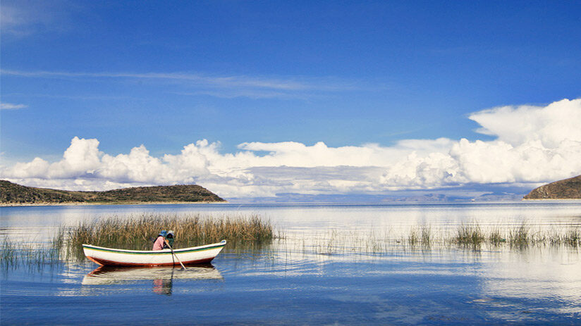
Also, the Lake Titicaca map shows about 25 tributaries that feed the Lake. Among them, only about 5 are relevant river systems. These are known as Suchez, Huancane, Llave, Coata and Ramis. The last one, Ramis is the largest system of all, since it drains about two-fifths of the entire Lake Titicaca basin. And despite the other tributaries and contributors, the lake has only one “outlet.” This exit is the Desaguadero River, which goes to Poopo Lake in the south, right in the region of Bolivia. And as for the analysis of the water, it is shown that it contains the presence and significant amounts of magnesium sulfate, calcium sulfate, sodium sulfate, and sodium chloride. Something that you cannot miss is a boat tour to Lake Titicaca.
Lake weather
Regarding its average temperatures, the surface of the Lake oscillates between 57 and 50ºF during the year. This is due to the sources of cold water and the strong cold wind that reaches Lake Titicaca. Winter takes place between the months of June and September when the deep waters can oscillate between 50 and 52ºF. Therefore, Lake Titicaca has only 1 season of free movement. It is the strong gelid winds and the large amount of sunlight (which burns) that evapotranspiration produces. A hat, sunglasses, thermal jacket, and sunblock will be your allies to face the climate of the lake! Of course, all these things have to be planned in your list of the best things to do in Puno, the closest city to Lake Titicaca.
Lake Titicaca Islands
As shown on the Lake Titicaca map, it is made up of a variety of islands. Both on the side that is in Peru and on the side that is in Bolivia. Most of them contain the archaeological rest of ancient cultures, with their amazing stone architecture. Besides traditions and costumes of these cultures and the millennial Aymara civilization that keep and practice current Lake Titicaca island inhabitants.
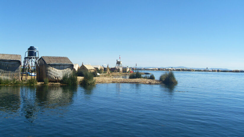
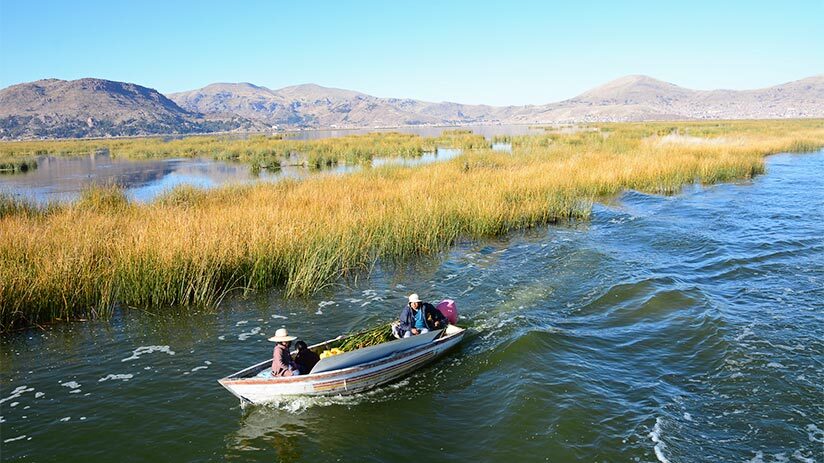
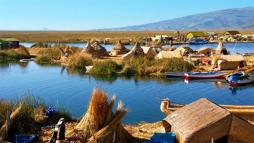
Uros Islands: Within Peru, you can see the floating islands of the Uros, some wonderful places to know in-depth. Where you will find a group of more than 40 islands made entirely of Totora reeds that float adrift. These islands developed their own costume and traditions. Therefore, these have become a great attraction due to the convivial tourism options.
Amantini island: On the Peruvian side, there is also the Island of Amantani, where about 10 communities with about 4000 inhabitants coexist. From this place, you can visit two ceremonial centers, Pachatata and Pachamama. And realize different activities like sailing in boats, riding horses, handicraft fishing, a participatory exhibition of textiles, and participation in agricultural tasks – livestock.
Taquile Island: Also, among your list of the best things to do in Peru, Taquile island must not be missed. You can get to know the Island of Taquile, an island that was a famous Peruvian prison during colonial times (Similar to Alcatraz in the United States). But today it stands out for its inhabitants and their culture, full of nuances that are reflected in textile-artisan traditions. For example, the male inhabitants usually dress and weave hats using specific colors and iconography according to their marital status. In the case of the women, they do the same thing, only they weave belts instead of hats.
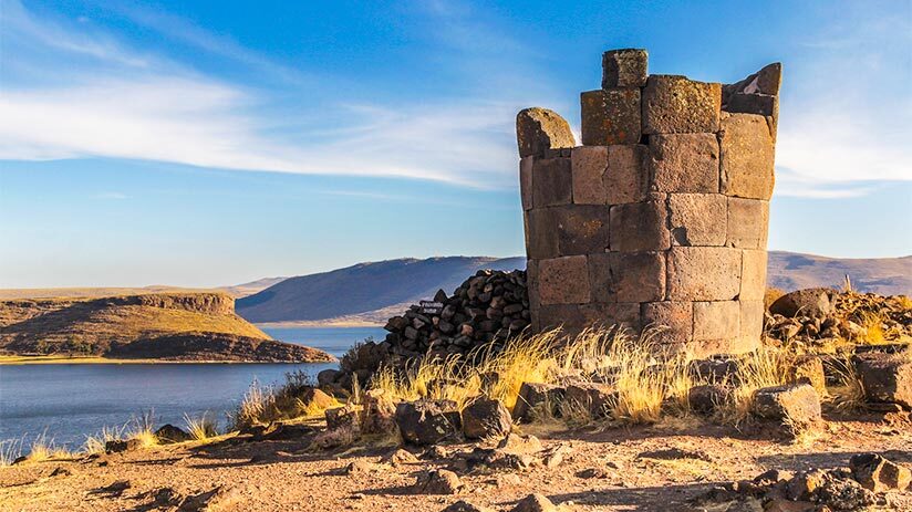
Sillustani Island: If we pay attention to the north zone of the Lake Titicaca map, we can realize that is located the Sillustani Island, close to Umayo lagoon. There, an ancient pre-Inca culture, the Collas, left a beautiful cemetery made up of well-carved stone towers, with a form of inverted truncated, many of them 12.5 meters in altitude, called Chullpas. Inside of them, the Collas buried their mummies. First, they mummified their dead, then they placed them in a fetal position inside these tombs (Chullpas), then they placed their most valuable belongings next to the dead person, and then the tomb was covered (stoned).
Isla del Sol (Sun Island): It is one of the largest islands in the Lake, and it is located in the Bolivian part. This island is known for having a somewhat mountainous, rocky, and hard terrain. About 800 families live there and work in traditional ways. Within the island, you can see approximately 180 pre-Inca ruins. Among them, the “Sacred Rock” is a big stone where a legend affirms that Wiracocha (god maker of all) was born and spawned to Manco Capac and his wife, Mama Ocllo, the first Incas. A pre-Inca labyrinth and an Inca palace. Definitely, It is an island that is worth visiting.
Isla de la Luna (Moon Island): Inside the Lake Titicaca map, the Island of the Moon (Koati island) is another of the wonders to know. It has a great variety of interesting places and historical sites. There, you will find the Iñakuyu or Palace of Sun’s virgins, a charming Inca palace where women (previously chosen by their beauty) lived and were prepared to serve in the Sun cult or to be that main or second wife to the Inca sovereign. A legend affirms that Wiracocha spawned on the moon there.
Suriki Island: Now, Suriki Island is not as big as its sisters, but it is also located within Bolivia. It is an island that is known for the manufacture of reed boats, that continues to do it nowadays.
Titicaca experience
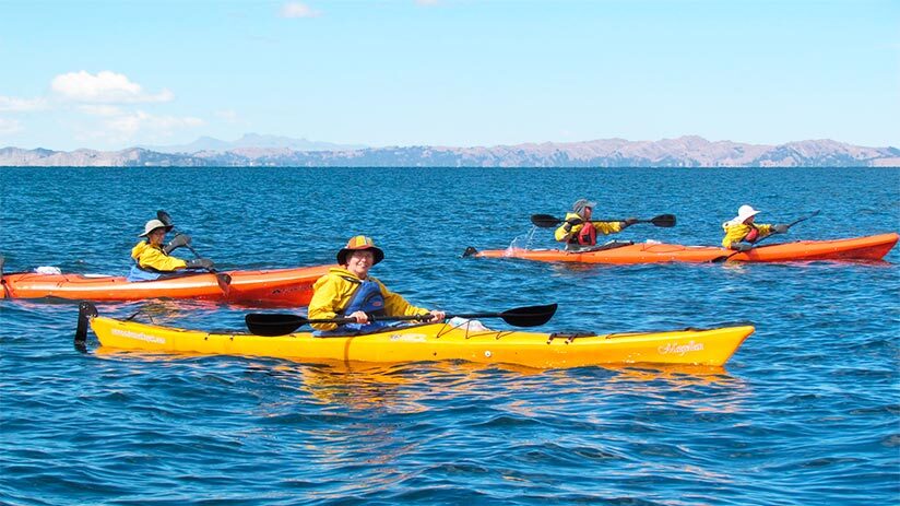
But, the Lake Titicaca map hides much more than islands and little lagoons. The experiences that you can enjoy over its water and around it are many. The hotels located around it or on paradisiacal islands offer a variety of experiences like paddle surfing, kayaking, Lake Titicaca boat tour, or in Tototora horses (kind of handicraft kayaks made up of reeds), spa sessions on the shores of the lake, trekking on its coasts among others. Besides these hotels, the local travel agencies have been improving their services in recent years. But, if you want security, luxury, and comfort, Machu Travel Peru will attend to your desires at all moments.
“THE STILL WATERS OF A LAKE REFLECT THE BEAUTY ALL AROUND IT. WHEN THE MIND IS STILL, THE BEAUTY OF THE SELF IS REFLECTED IN IT”
As you will see, the map of the lake is made up of an incredible series of facts. From wonderful natural landscapes to unique traditional cultures. And being able to know everything that this awesome place offers is a once-in-a-lifetime opportunity. We hope this short article on the Lake Titicaca map has helped you. The Machu Travel Peru team knows very well what it can be to organize a trip to Peru. That is why we want to help you with everything you need. Don’t miss out on this wonderful opportunity and start organizing right now. What are you waiting for? Check our different travel packages.